$460,000

CA 6 & CA 7/119 Honeysuckle Road, Lauriston VIC 3444

Land
Block size: 11 m² approx.

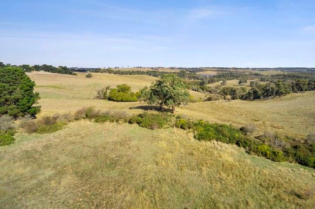
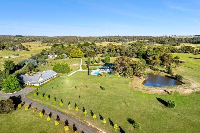
Picturesque Farmlet with Postcard Views

Offered as a whole or separately

These 2 mostly cleared acreages of 6.88 Hectares (17 Acres) and 5.16 Hectares (12.75 Acres) respectively, offer postcard views to Mt Macedon and neighboring farmland. A rare offering in a highly sought after district, this hilltop sanctuary is around 10 minutes to Kyneton, 6 minutes from Malmsbury and only 90km (60 minutes) from Melbourne Airport.

The surrounding area has an exemplary reputation as a cool climate grape growing area, and for permaculture.

The sunny north, east and west facing slopes present a viable viticulture option, as the region is well known for producing cool climate wines, having been reintroduced by Tom Lazar, formerly 'Virgin Hills vineyard', on Salisbury Road in 1968.

Access from the sealed Honeysuckle Road

Mains Power nearby

The property would support a sustainable agricultural enterprise such as a vineyard, olive grove or stone fruit orchard or equally suitable for equine activities.

*Note: the property is zoned Farming (FZ) and there is no 'As Of Right' ability to build a dwelling on the property under the Macedon Ranges Shire Planning Scheme. A Planning Permit will be required, and we can give no guarantee that a Permit will be granted, notwithstanding there have been some recent planning approvals on similar size farmlets that were supported with an adequate Farm Management Plan.


** We have obtained all information in this document from sources we believe to be reliable, however, we cannot guarantee its accuracy. Prospective purchasers are advised to carry out their own investigations.

Inspections

No inspections scheduled on Allhomes, yet. You may ask the agent about upcoming inspections.

Send an enquiry

Contact Robert Broadhurst to learn more about this property, request an inspection or take an online tour.

Key details

Property type:
Land
Block Size:
11 *

Other Details

Maps and area information

Block information
Block size: 11 (approx)
Block Map
No block information available
Measurements are estimates only and based on data provided under licence from © PSMA Australia 2024.
Sorry, overlays are not available for this address
Need more info? We've got you covered.
A block's planning zone defines how that land can be used and what can be built on it.
A right to use a part of land owned by another person for a specific purpose. The most common forms of easements are for services, such as water, electricity or sewerage.
The value of a block of land without any buildings, landscaping, paths, or fences. This is different to the block's market value. A block's unimproved value is used to calculate rates and land tax charges.
This represents the shape of the geographical land. Closely spaced contour lines represent a steep slope. Widely spaced lines represent a gentle slope.
Enrolment areas for ACT public schools.

Property history

We couldn't find any history for this property.
See Lauriston's suburb profile

Statement of information

Section 47AF of the Estate Agents Act 1980
Download Statement of Information
Indicative selling price, median house price for the suburb and comparable sales information has been provided by the agent in compliance with Estate Agents Act 1980.

Lauriston suburb information

A little bit about who lives locally, as provided by government census data
SummaryMedian sales
Average Age
46 years
Population
247
Listing ID: 182553702. This listing has been viewed 1 time. It was first displayed on 27/05/2024 and last updated on 01/07/2024.
Allhomes acknowledges the Ngunnawal people, traditional custodians of the lands where Allhomes is situated. We wish to acknowledge and respect their continuing culture and the contribution they make to the life of Canberra and the region. We also acknowledge all other First Nations Peoples on whose lands we work.
"With open hearts and minds, together we grow." artwork by David Williams of Gilimbaa.