New photos chart Gungahlin region's rapid growth as population booms
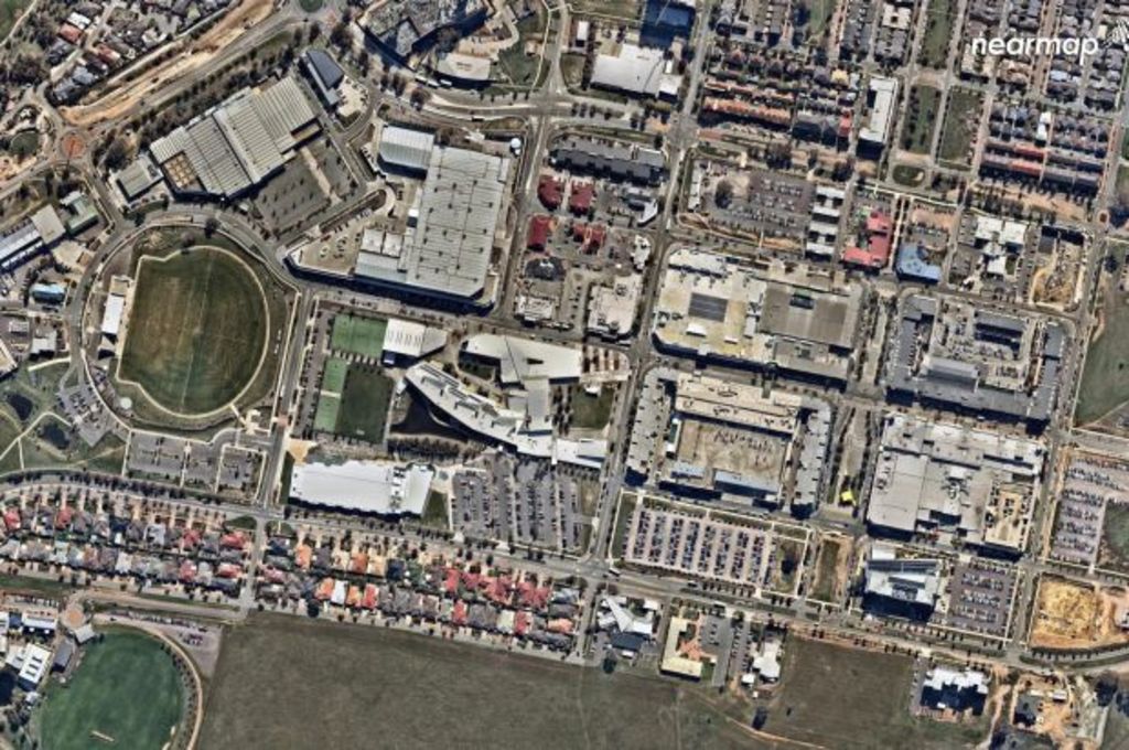
New aerial images of Gungahlin chart just how rapidly the landscape of Australia’s second-fastest growing region has changed over the past five years.
The population of Canberra’s youngest satellite town surged by 50.4 per cent between 2011 and 2016, from 47,303 people to 71,142 people, according to ABS data.


Canberra’s Gungahlin has housed an extra 24,000 people in the past five years. Source: Nearmap
Gungahlin’s growth has been captured by Nearmap.com.au, which has released before and after photographs of the country’s 10 fastest growing regions.
They include aerial images charting the progression of the Gungahlin Town Centre and the transformation of Moncrieff from green space to a new suburb.
Nearmap chief executive officer Rob Newman said the imagery highlighted the Gungahlin region’s rapid growth as more and more Canberrans migrated north.
“From the ground it can be difficult to see the pace at which Australia is growing but when you look at it from the air, you can observe in incredible detail the change occurring across our country, even just in the last five years,” he said.
The ACT has recorded the largest population growth of all states and territories over the past five years, according to 2016 census data released in June, with the Gungahlin region driving the boom.
Australia’s fastest-growing region ahead of Gungahlin was the Shire of Serpentine Jarrahdale, south of Perth, with a population spike of 50.90 per cent.
- Related: Canberrans shifting from houses to units
- Related: Where are Canberra’s highest mortgages, rents?
- Related: Where are Canberra’s largest houses?
Melbourne city was the country’s third-fastest growing region with population growth of 45.2 per cent.
Gungahlin’s growth coincides with surging property prices.
Harrison house prices have more than doubled, jumping 104.6 per cent to $628,000 as of December 2016.
In Crace and Bonner prices have jumped 66.7 and 62.5 per cent respectively.
Canberra’s median house price is $723,299, according to Domain Group data for the June 2017 quarter.
We recommend
States
Capital Cities
Capital Cities - Rentals
Popular Areas
Allhomes
More
- © 2025, CoStar Group Inc.

